June 28 – July 20 2002 Clarke
Thelon River Trip log
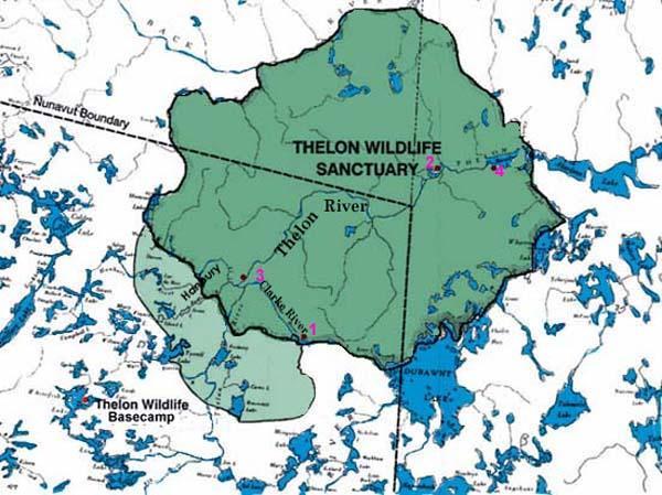
The Clarke Thelon
River system is the easy way into the Thelon Game Sanctuary
avoiding all portages that 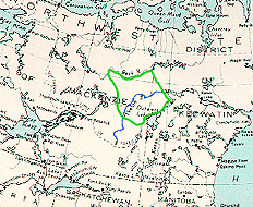 can make the trip a much more demanding trip. We chose
to get there through Transwest Air in Lynn Lake, as it is a much shorter trip
than going through Yellowknife
for anyone coming from Manitoba or anywhere south and east of us. The flight from Lynn
Lake is longer and more expensive than from Yellowknife
but you avoid the trip to Yellowknife.
can make the trip a much more demanding trip. We chose
to get there through Transwest Air in Lynn Lake, as it is a much shorter trip
than going through Yellowknife
for anyone coming from Manitoba or anywhere south and east of us. The flight from Lynn
Lake is longer and more expensive than from Yellowknife
but you avoid the trip to Yellowknife.
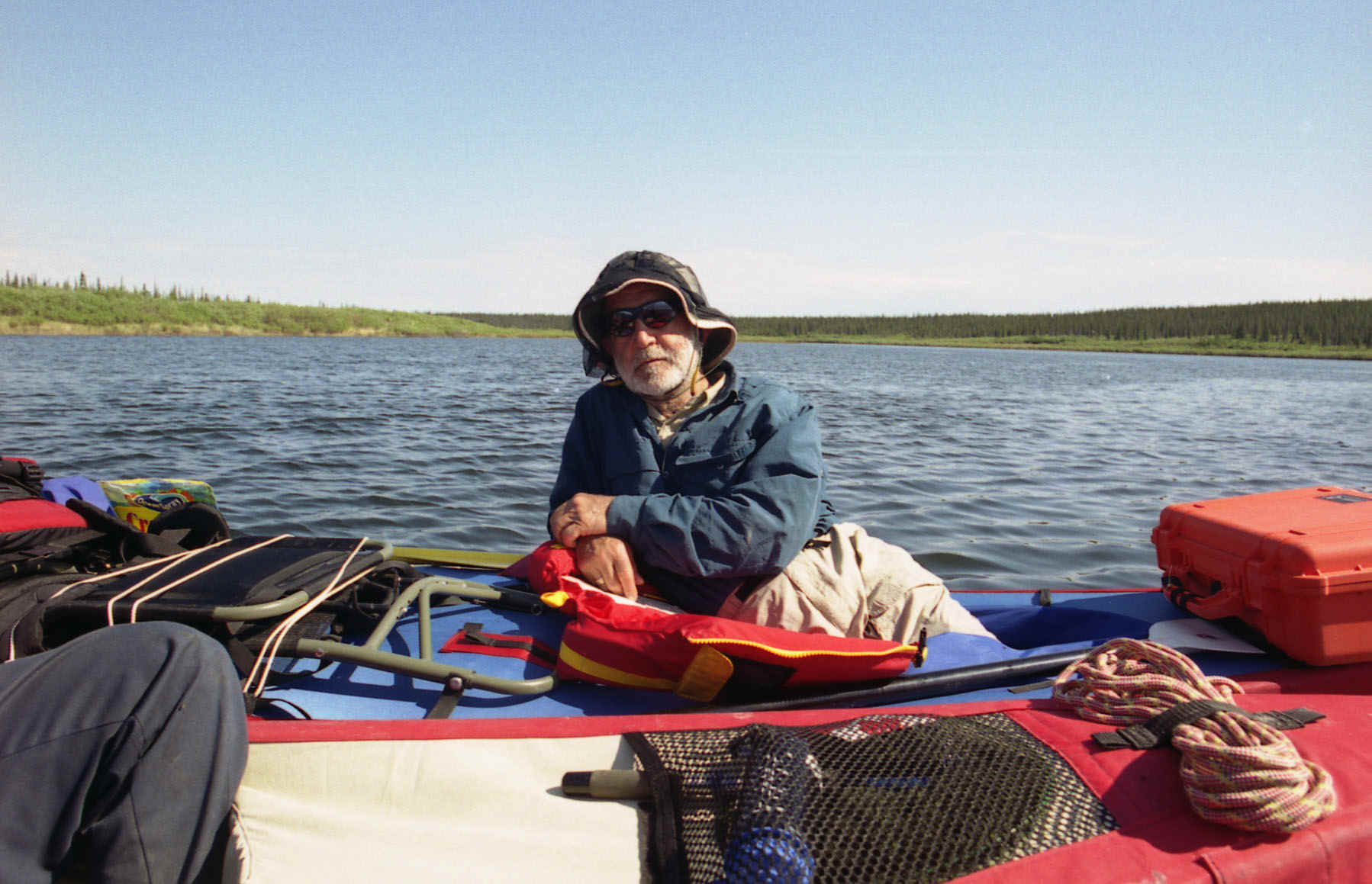
The trip team consisted of Art, Bob, Roy, Frixos, Joe, and Ross. Joe
and Ross where new additions to the team as a 6 person team filled a twin otter and was the
most cost effective way of getting to our starting point on the Clarke.
We packed up and met with Joe and Ross as they were coming in from
Ontario early afternoon of June 28th. With 2 large pickups we had plenty of
room of all our gear and 21 days of food. We were off for Lynn Lake. It is a full day trip
and our flight was scheduled for Sunday morning so we spent a night a Hobb’s Camp 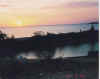 on
Cedar Lake just north of Grand Rapids. This
gave us plenty of time on Saturday to visit Pisew
Falls
on
Cedar Lake just north of Grand Rapids. This
gave us plenty of time on Saturday to visit Pisew
Falls 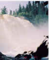 south of Thompson on our way to Lynn Lake.
The falls are quite spectacular and well worth the side trip to see.
south of Thompson on our way to Lynn Lake.
The falls are quite spectacular and well worth the side trip to see.
We made a quick stop in Thompson to top up our
supplies and eat. The road to Lynn Lake is better than I had expected from the comments I
had heard but it is a mix of pavement and gravel sections.
June 29th we arrive in Lynn Lake and check
in with Transwest Air . We are ready for
our fight tomorrow morning. We head out for a camping site ready to start of our great
northern adventure. The next morning looks dull and dismal. After packing we head of to
the Transwest Air to learn that
flights are not making it through to their destination due to low visibility. There are a
number of flights backed up. We head off for a breakfast at Lynn Inn and a day touring the
sites of Lynn Lake.
It is disheartening to see the conditions the mine companies have left
the town. Many boarded up buildings, many burned homes. The mine tailing are quickly
killing the surrounding life. It surprises me that government that have professed for a
hundred years that the north is the future have let the devastation go on and have seemed
to be able to do little to enhance the life of these northern communities. Lynn Lake will need provincial help
to stay alive and it is in Manitoba’s best interests keep towns in the north viable.
Joe is a former Inco employee from Sudbury and gives us a informed tour
of the mine operation in the area.
The weather does not improve and we spend the night a Lynn Inn rather
than set up camp again in the rain. Along with a number of fishermen from the states are a
geological survey team and a large group of canoeists from a camp in Minnesota waiting for
a plane out. Looks like we will be spending Canada Day in Lynn Lake and not on the Clarke River
as planned.
Canada Day in Lynn Lake
is quiet as everything is closed but we do help them celebrate by joining the parade route
with flags and enthusiasm. Even in the wet weather, people are out enjoying the day. The
main problem for celebrations is no fireworks, as darkness does not fall early in Lynn
Lake.
Another night at the Lynn Inn, with a promise to get us out tomorrow.
At least we get to see Brazil knock off Germany in the world’s cup. The weather is a
very unusual delay. The fishermen say this is there first delay in more than 20 years.
We get up early and we prepare for the trip. The low clouds have risen.
At Transwest Air we pack the plane.
It is a tight squeeze to get 3 canoes and all our gear in a twin otter.
We are off for Kasba
Lake our refueling stop at the Four
Corners (Saskatchewan, Manitoba NWT,
Nunavut). Now it’s off to the Clarke. We pass over tundra – frozen
lakes. Lake Dubuant is frozen almost solid. The American canoeists are going to
need their planned forty days to get though their trip. We are heading a little more west
and are hoping our proposed landing site is ice free. Finally we see the Clarke, 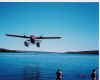 the lake is open the
sun is shining, the weather warm. The plane touched down softly on the water. Our pilot
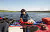
Todd can park this plane like a Vokeswagon. We unpack and the 6 of us are soon abandoned
on the banks of the Clarke. We
can hear the wolves disturbed by the commotion. First things first. We take a swim before
packing the canoes for the first campsite. The water is cold about half an inch.
the lake is open the
sun is shining, the weather warm. The plane touched down softly on the water. Our pilot
Todd can park this plane like a Vokeswagon. We unpack and the 6 of us are soon abandoned
on the banks of the Clarke. We
can hear the wolves disturbed by the commotion. First things first. We take a swim before
packing the canoes for the first campsite. The water is cold about half an inch.
We had not planned to travel far the first day. Even though we were a
couple of days late getting in we had plenty of time to do our 350k trip. We looked for a
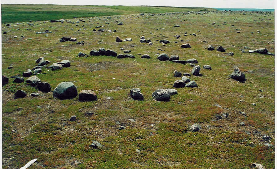
campsite and quickly found an excellent spot used often, as there were signs of ancient
tent rings and stone tool flaking sites in and around our camp.
Fish for dinner and breakfast was a delightful addition. The screened gazebo was an oasis
from the mosquitoes. Anyone from Winnipeg would be amazed at how big and plentiful they
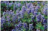
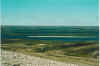
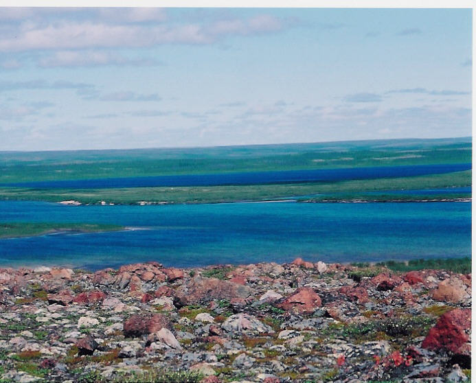
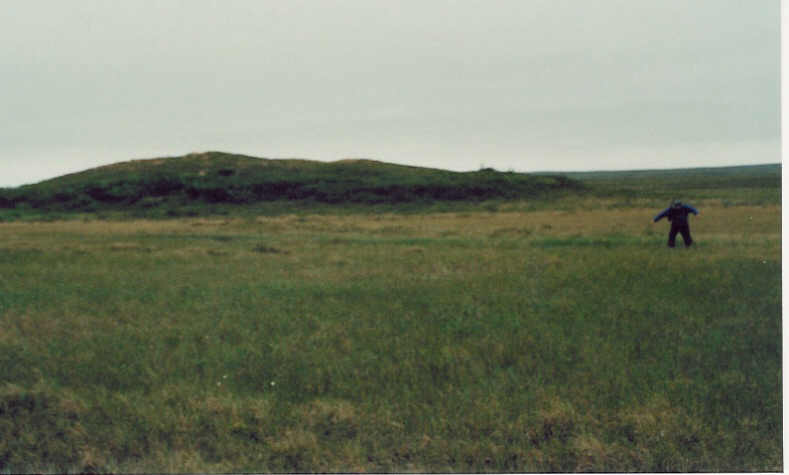
could be. We hiked the tundra behind our camp. The barren lands moniker does not do it
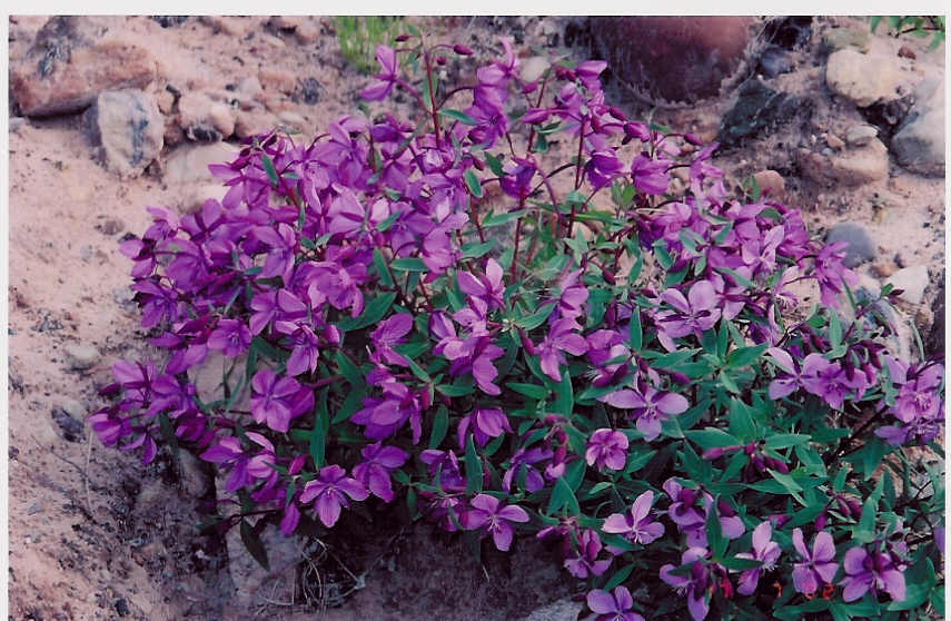
justice, as it is a place of variety and beauty. Here in what is considered the Thelon
valley is a treed environment where wildlife abounds judging from the footprints as all
mammals seemed to keep well out of site. 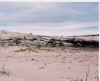
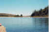
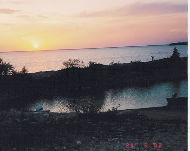
The day goes on and on, the sun does set close to midnight and rises
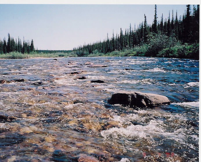
before 3:00 am but it is never very dark. The Clarke is a fast flowing little
river with lots of ripples and class 1 rapids that are easy to maneuver. The valley is
full of birds, Canada Geese, ducks, hawks, falcons and eagles. The
tundra is covered by caribou trails where hundreds of thousand caribou make there way to and from the
Beverly Lake calving area to the
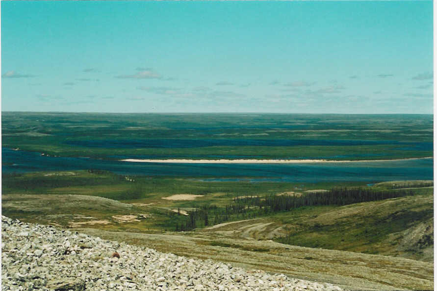
tree line for winter. The canyons and sand dunes of the Clarke provide for an enchanting voyage on our
first 2 days down to the mighty Thelon. It is hot warm enough
to take a very quick swim in the river.
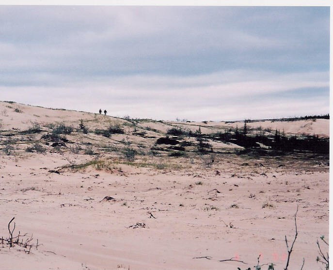
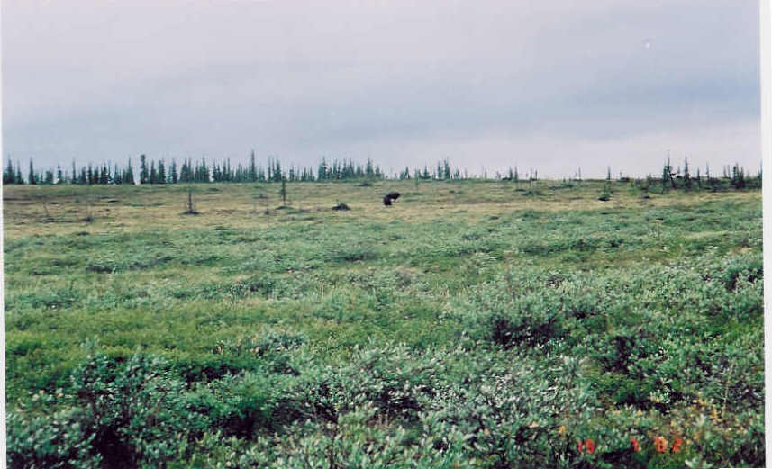
The hikes through the sand dunes prove that the grizzley roams the barrens leaving
prints deep in the sand but we still glimpse only an arctic hare. Then as we are about to
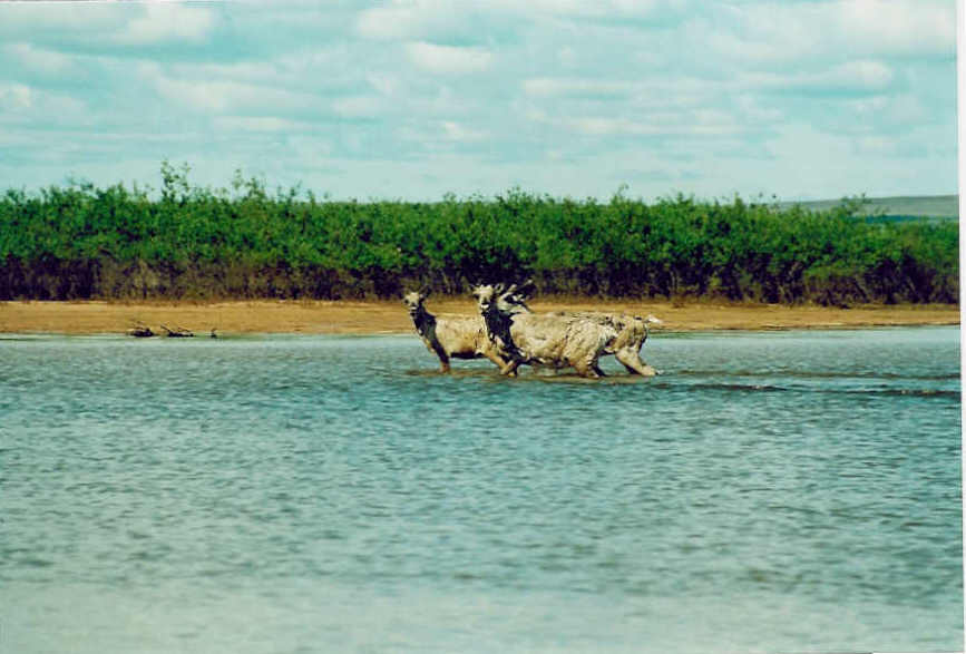
end our paddling day we site a light brown musk ox on the bank. It
gives us a cursory glance and moves off slowly up the bank and out of site.
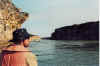
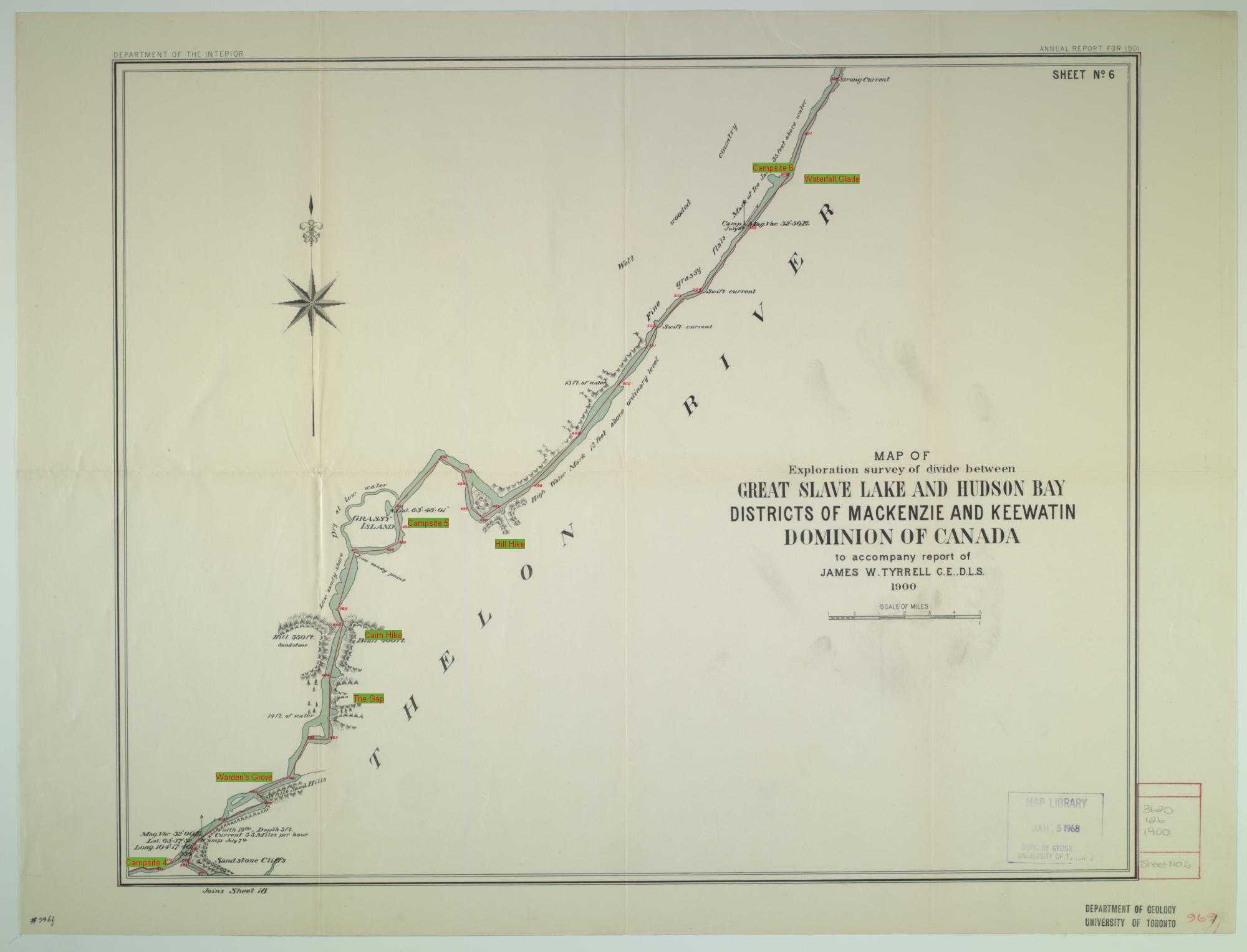
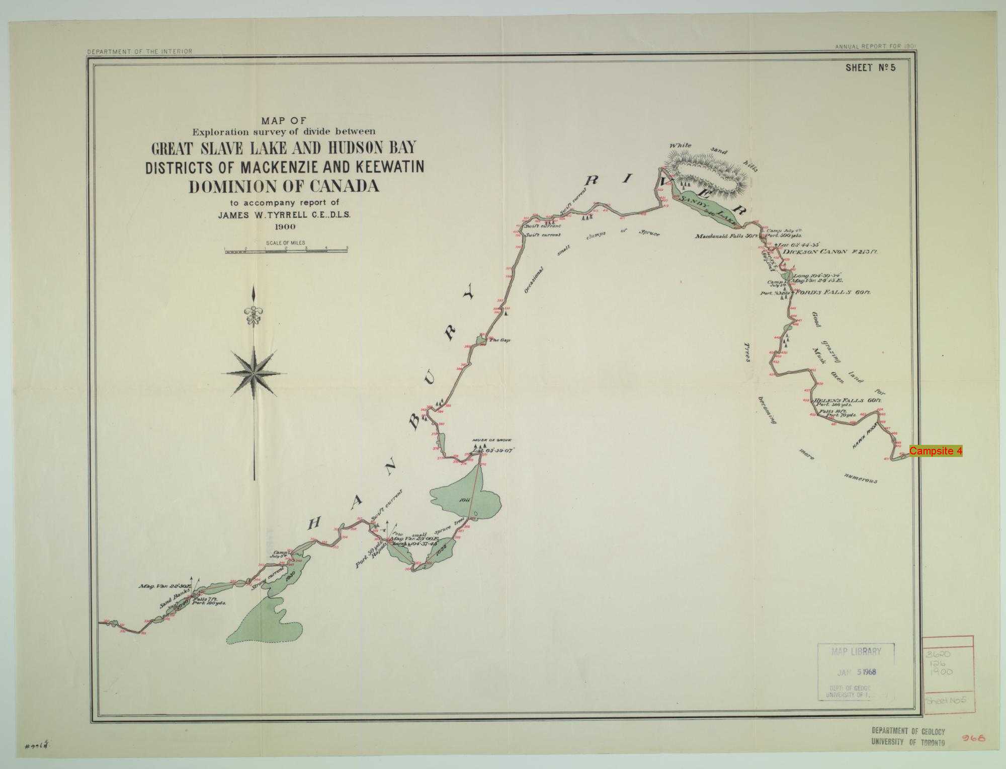
The weather is cooling off as we approach the Thelon
junction. 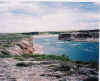 A hike is in the offing to see what we had
missed by not starting on the upper
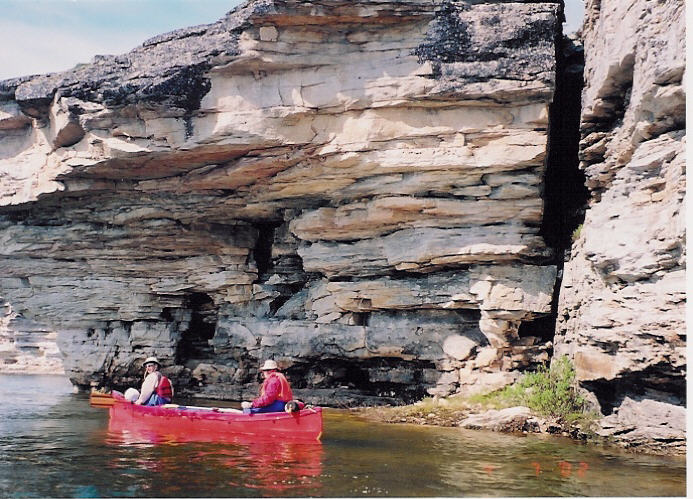
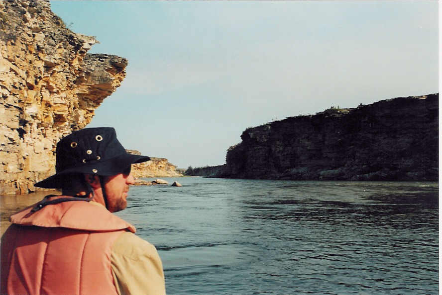
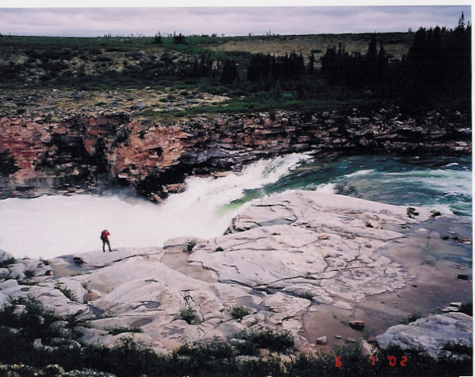
Thelon. The Thelon canyon cuts deep into the rocks. The rapids are massive at the
start of the 5-mile gorge. We are happy to have avoided the long portage. The water runs
fast and cold. It is not a place to test your paddling skills to the max. We camp on a
large gravel bar where the rivers meet. The next day we tackle the Thelon under the rust red
cliffs to get to the Hanbury.
There is a major rapid to run. It may be considered a class 2 but the cold and river speed
make us scout it carefully. On a cool day no one wants to spend time in this river.
A hike is in the offing to see what we had
missed by not starting on the upper
Thelon. The Thelon canyon cuts deep into the rocks. The rapids are massive at the
start of the 5-mile gorge. We are happy to have avoided the long portage. The water runs
fast and cold. It is not a place to test your paddling skills to the max. We camp on a
large gravel bar where the rivers meet. The next day we tackle the Thelon under the rust red
cliffs to get to the Hanbury.
There is a major rapid to run. It may be considered a class 2 but the cold and river speed
make us scout it carefully. On a cool day no one wants to spend time in this river.
We successfully get to the Hanbury and line upstream to a
campsite as we plan a long hike to Helene's
Falls the next day. One good thing about cool windy days is the freedom from bugs. On
windless days they can be gruesome, especially if you are not partial to them as
condiments with your drinks and meals.
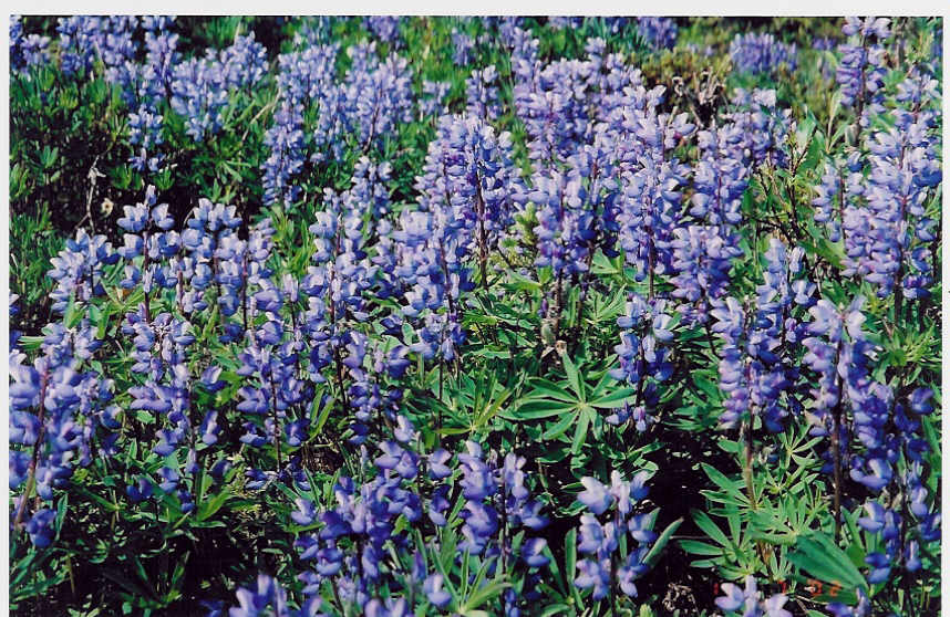
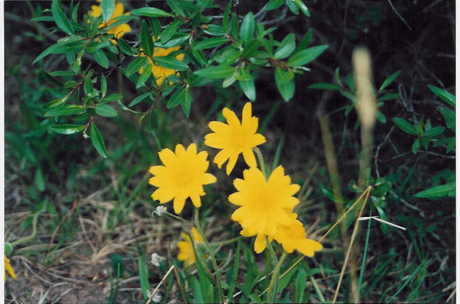
The hike to Helene's Falls 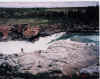 was
done almost straight line, not recommended. Through dwarf birch shrubs over tundra
hummocks, though treed thickets around and through muskeg and bogs, a great variety of
flora. The falls were worth the trip. An overhung falls with a spray of water filling the
air. A rough-legged hawk nesting in the cliffs downstream ripped apart a diner for its
young. The cairn at the falls contains a log of those who passed over the past 40 years.
Here in a land almost untouched by people the list of fellow travelers is not long. There
are as many signs of ancient civilizations as there is of us. We do not make the same
mistake on our way back to our campsite
and we follow the eskers and sand dunes. No caribou are sited but trails are everywhere.
was
done almost straight line, not recommended. Through dwarf birch shrubs over tundra
hummocks, though treed thickets around and through muskeg and bogs, a great variety of
flora. The falls were worth the trip. An overhung falls with a spray of water filling the
air. A rough-legged hawk nesting in the cliffs downstream ripped apart a diner for its
young. The cairn at the falls contains a log of those who passed over the past 40 years.
Here in a land almost untouched by people the list of fellow travelers is not long. There
are as many signs of ancient civilizations as there is of us. We do not make the same
mistake on our way back to our campsite
and we follow the eskers and sand dunes. No caribou are sited but trails are everywhere.
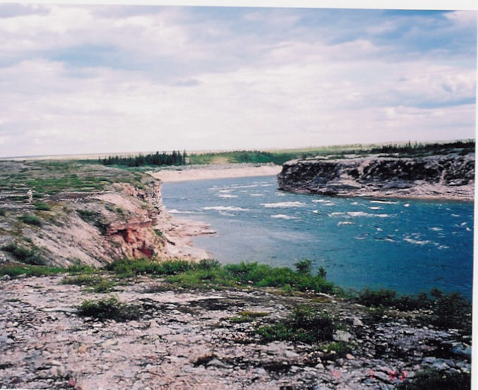
Back down the Hanbury to the Thelon we go. The wind
picks up and the rain falls, we are looking for Wardens Grove.
In a place with no signposts to find your way a GPS simplifies the search for any site but
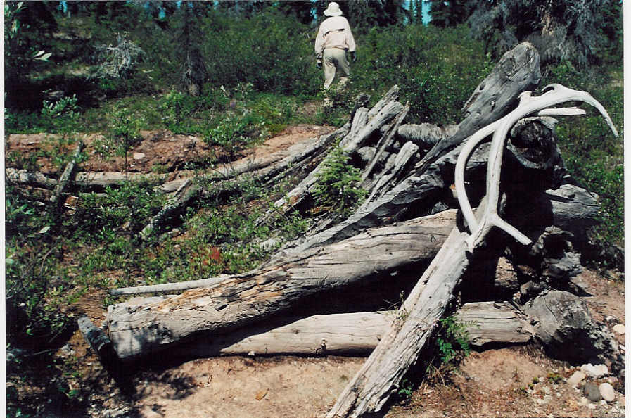
you have to have accurate information to start with. The Wardens cabin from 1928 still
exists. It has been used by archeologists in the past but is in poor condition. It does
provide us with a warm sheltered place for lunch. The Game Sanctuary was started to save
the musk ox and we had seen one. I hope we do better in the next week.
We continue down stream, a golden eagle on the riverbank seems to be as
weathered as we are from the cold wind and rain. As the rain stops we hike up the Gap, a high point on the river
with a cairn and a view of the Grassy
Islands beyond. Hiking in this land is very deceiving. The hill seems to move and grow
as you approach them but a good hike on a cool day is a great way to stay warm. We camp
opposite Grassy Island trying hard not to disturb a nesting bird in our campsite area. The
evening brings a clear sky and no wind. A wolf
is sited far down stream as a white dot on the shore. The mosquitoes hum us to sleep. It
is great to have good equipment. The tents remain a bug free haven and our tundra tarp
makes for a tolerable eating location.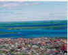


The sun slowly sets and I mean slowly. It is a beautiful night. The
birds sing and the mosquitoes hum.
As we start the day we interrupt 2 moose on the riverbank. They wander
off. It is amazing how such a large animal can quickly disappear. Past Grassy Island is a high point on the river where Inuit hunters
waited for caribou. We hike up the hill and can view the barrens for miles in every
direction. Any animals have
kept well hidden. It is not as if they do not know we are there, the birds announcing our
coming well in advance. The sand saves the footprints of all that were there in the past
few days. There have been lots of animals as well as other people.
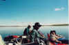
Down stream at a swift we do some fishing. A couple of canoes catch and
pass us (two American couples from Chicago and Wisconsin). They are on their way to Baker
Lake after starting well up the Thelon on lakes north of Saskatchewan. We continue down
stream towards Waterfall Glade looking for a campsite. We found a site opposite the glade
as the sites there were taken by the Americans. We did have fish for dinner. It had been a
long day and we were treated to another long sunset.
The riverbanks are steep, plowed by the ice for 50 to 60 feet from the
current water level. We had seen large blocks of ice on the banks and snow still packed
into low protected areas in the low hills. Waterfall Glade has
been plowed flat and makes a great site with a 50 waterfall from the high hills behind the
campsite. We head a little down stream to check out Ernie Kite’s cairn. From there we
see a cow moose on the opposite bank. It was getting hot and sunny. With little wind we
raft together and have lunch floating down river at 7kph.
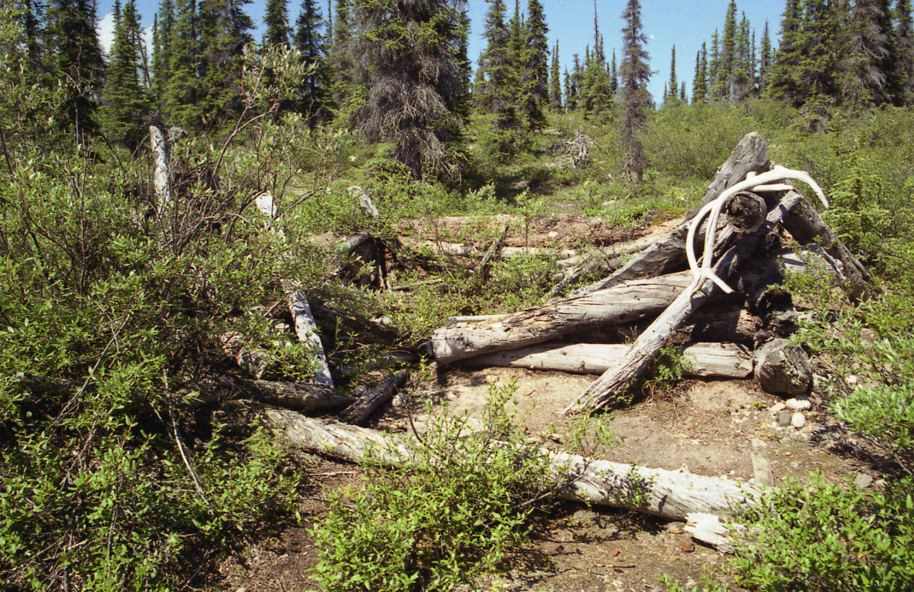
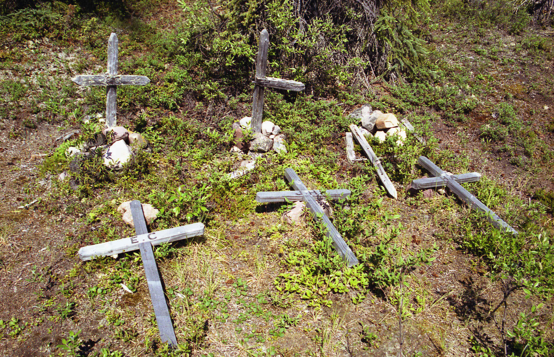
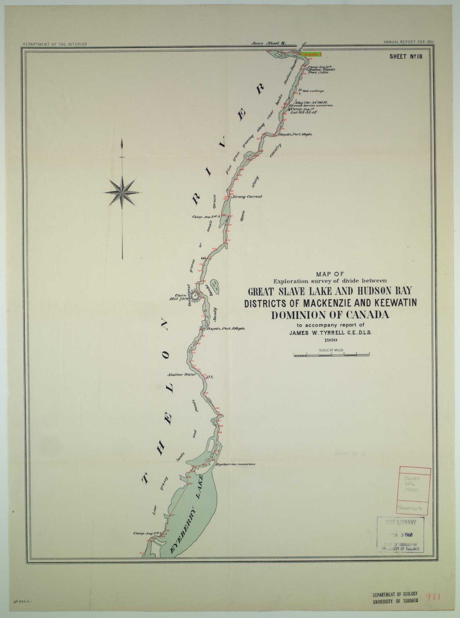
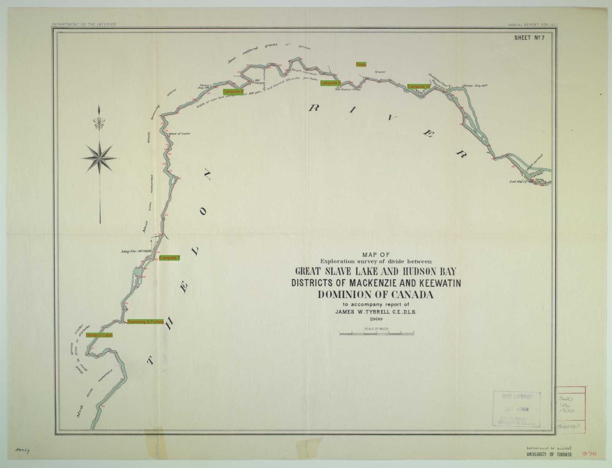
We find Jack Hornby’s cabin 
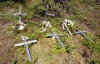 by the
tree stumps still in front of it. Jack convinced the Canadian Government to create the
sanctuary but had the misfortune of missing the caribou when he decided to winter here in
1926/27. He starved to death with his friend Harold Adlar and his nephew Edgar Christian.
Edgar’s diary of their plight was found in their stove and their graves are marked
just outside the cabin. We had a quick swim at the cabin then continued down the Thelon to
a small stream to fish.
by the
tree stumps still in front of it. Jack convinced the Canadian Government to create the
sanctuary but had the misfortune of missing the caribou when he decided to winter here in
1926/27. He starved to death with his friend Harold Adlar and his nephew Edgar Christian.
Edgar’s diary of their plight was found in their stove and their graves are marked
just outside the cabin. We had a quick swim at the cabin then continued down the Thelon to
a small stream to fish. 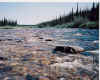 It was hot, swimming was better than
fishing.
It was hot, swimming was better than
fishing.
We camped down stream and watched the arctic terns hover in the wind
over the river picking bugs off the surface. They were not pleased to be sharing their
location with the gulls. Rain again, It does not rain hard here but seems to rain often.
The weather changes quickly. With the disintegrating of a nice day we went to bed early
and left the tundra to the birds and mosquitoes.
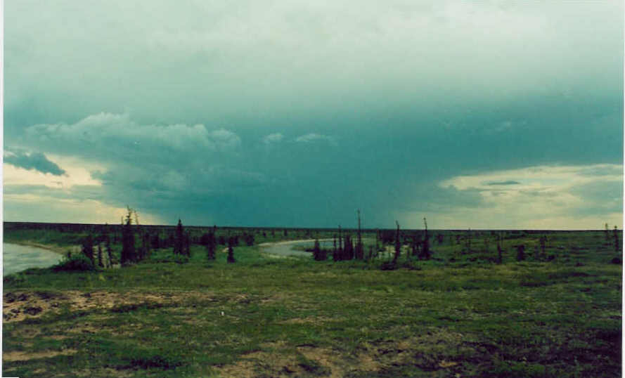
Thunder storms,  they are fairly rare in the tundra and they
miss us all day until we are ready to eat. Fortunately we have scotch, a nice break from
the usual. We retreat to our tents have a drink play cribbage and wait out the storm. Next
day a little hiking and a float down river. Though the rocky canyons we float upsetting
the hawks that scream at our presence. We stop at a stream in hope of good fishing. While
some of us hike through the tundra, Roy catches a 32-inch by 14-inch lake trout. It makes
a great dinner with the lemon penne pasta.
they are fairly rare in the tundra and they
miss us all day until we are ready to eat. Fortunately we have scotch, a nice break from
the usual. We retreat to our tents have a drink play cribbage and wait out the storm. Next
day a little hiking and a float down river. Though the rocky canyons we float upsetting
the hawks that scream at our presence. We stop at a stream in hope of good fishing. While
some of us hike through the tundra, Roy catches a 32-inch by 14-inch lake trout. It makes
a great dinner with the lemon penne pasta.
We start the day with a short hike to give our tents some time to dry
and then take to the river. Down stream we plan to hike to a pingo.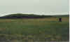 It is about 4 k from
the river across varied tundra. A moat surrounds the pingo full off siksik holes. The siksik as always,
remain well hidden. They do not want to attract the grizzly that digs them out for dinner.
It was a wet walk through the moat but the rain kept us from being dry anyway. At camp
tonight the patter on the tent walls is not the mosquito.
It is about 4 k from
the river across varied tundra. A moat surrounds the pingo full off siksik holes. The siksik as always,
remain well hidden. They do not want to attract the grizzly that digs them out for dinner.
It was a wet walk through the moat but the rain kept us from being dry anyway. At camp
tonight the patter on the tent walls is not the mosquito.
We finally get to Lookout Point. Another
Inuit site used far into the past, providing a great view of the rivers and tundra
surrounding us. There is sand everywhere, a sandbar in the river, huge sand beaches and
dunes drifting across the tundra. We camp at a huge beach on the Finnie River just
upstream from the Thelon. There is a tern nest at the far end of the beach and they are
not happy to share their end of the beach with anyone. They attach any that approach.
While leaving the Finnie, site we see an
arctic hare on an island in the Thelon. We do a few short hikes and as we approach a
campsite for the night see a large arctic wolf nearby. We do find more signs of more
recent human habitation, part of a novel and a rusty can. Usually we only find archaic
remains as the people coming to this area make a effort to leave it pristine but there
were a lot of trappers early in the century and they may have been less concerned.
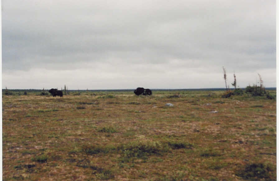
It was windy and it was cold. We were paddling into the wind most of
the day. We get a break as the high riverbanks protect us from the wind. There on the bank
ahead Ross sees two moving black spots. As we approach, a plane flies overhead. 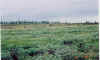 We
fear that the muskox have been spooked but land and climb the bank to see them sill close
by. They back off a little as we approach but then change tactics and approach us. As with
did not back off they make a short run. Deciding we are not a threat they saunter off
around a small pond and then up and over a hill.
We
fear that the muskox have been spooked but land and climb the bank to see them sill close
by. They back off a little as we approach but then change tactics and approach us. As with
did not back off they make a short run. Deciding we are not a threat they saunter off
around a small pond and then up and over a hill. 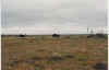
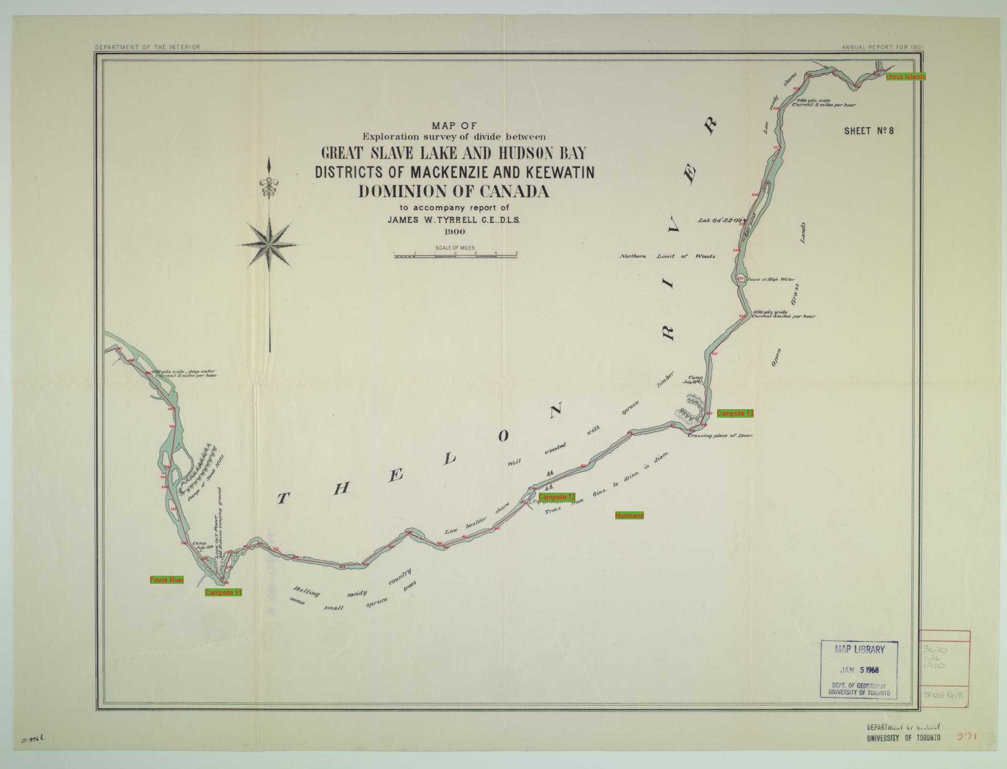
We finally get to Nunavut. It was rainy
windy and cold we pass the area Tyrrell named crossing of the deer.
It is a wide flat area where it would be easy for caribou to cross and as always there
were many trails here. The wind was very strong and it was cold. It was time to stop and
warm up. We built a fire and dried out had dinner and went to bed early.
We had listened to the wind and waves all night but by morning it was
dry and the wind much less. It was much easier to make good time on the river. We met our
second group on the river, a Tundra
Tom party out of Yellowknife. They had just weathered yesterday and were waiting for a
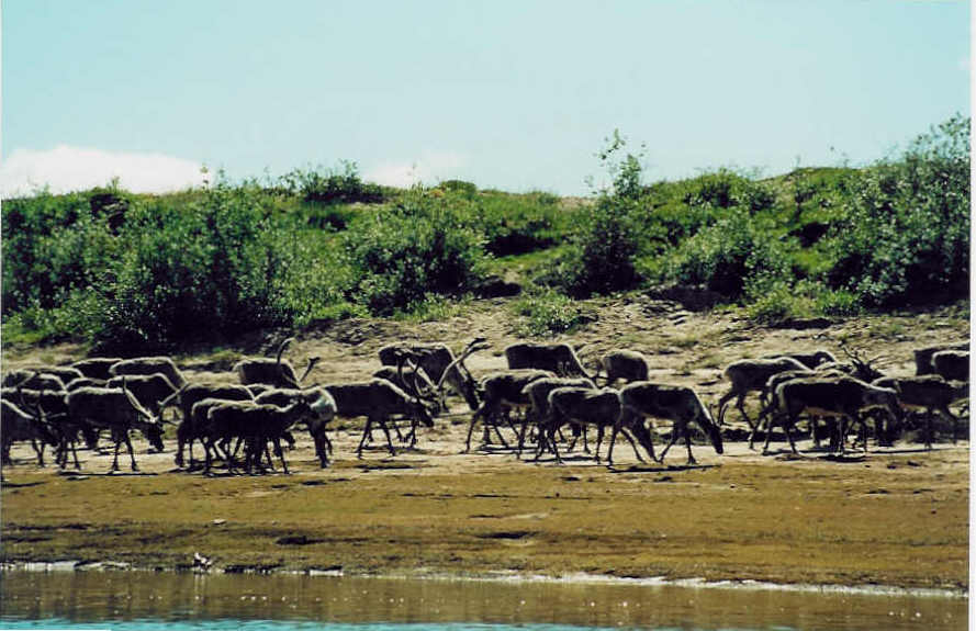
plane out. Too bad this day was beautiful.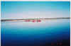 We continued downstream and finally saw
them. About 30 caribou walk the shore towards
We continued downstream and finally saw
them. About 30 caribou walk the shore towards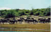 us very
unconcerned about out presence. They walk by as we snapped pictures. We were ahead of
schedule and floated for a while in the warm day’s sun. More caribou are sighted both
on shore and crossing the river.
us very
unconcerned about out presence. They walk by as we snapped pictures. We were ahead of
schedule and floated for a while in the warm day’s sun. More caribou are sighted both
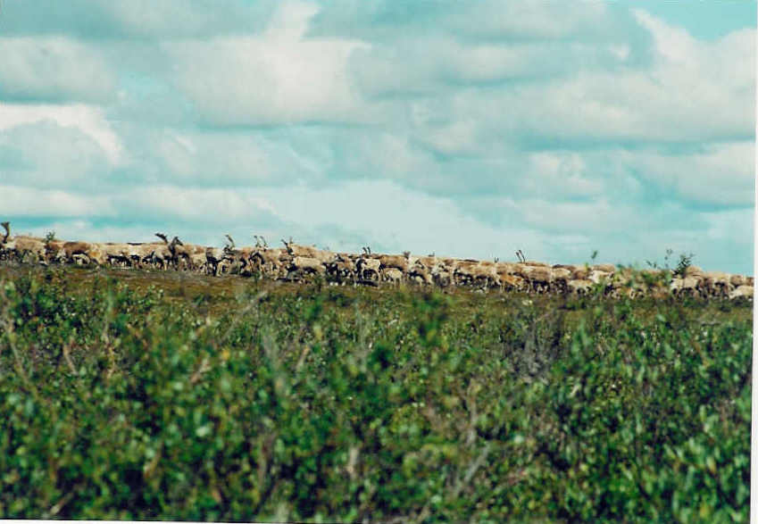
on shore and crossing the river.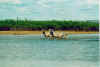 Then further downstream we see about 20
crossing the river. They are very anxious about us. There is a large herd of about 500
caribou on shore
Then further downstream we see about 20
crossing the river. They are very anxious about us. There is a large herd of about 500
caribou on shore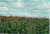 . We land to try to get a closer view. We
try to stay down wind. The shore is lined with a thick bush of dwarf birch. We make our
way through trying not to spook the herd. We do spook the wolf that was prowling for its
dinner. A very large white arctic wolf bounded out of the bush in front of us. He spooked
the herd and it quickly moved away. In the distance we notice the hill turning gray as
another large herd moves down it towards the Tammarvi River. We
are now past the Ursus Islands.
. We land to try to get a closer view. We
try to stay down wind. The shore is lined with a thick bush of dwarf birch. We make our
way through trying not to spook the herd. We do spook the wolf that was prowling for its
dinner. A very large white arctic wolf bounded out of the bush in front of us. He spooked
the herd and it quickly moved away. In the distance we notice the hill turning gray as
another large herd moves down it towards the Tammarvi River. We
are now past the Ursus Islands.
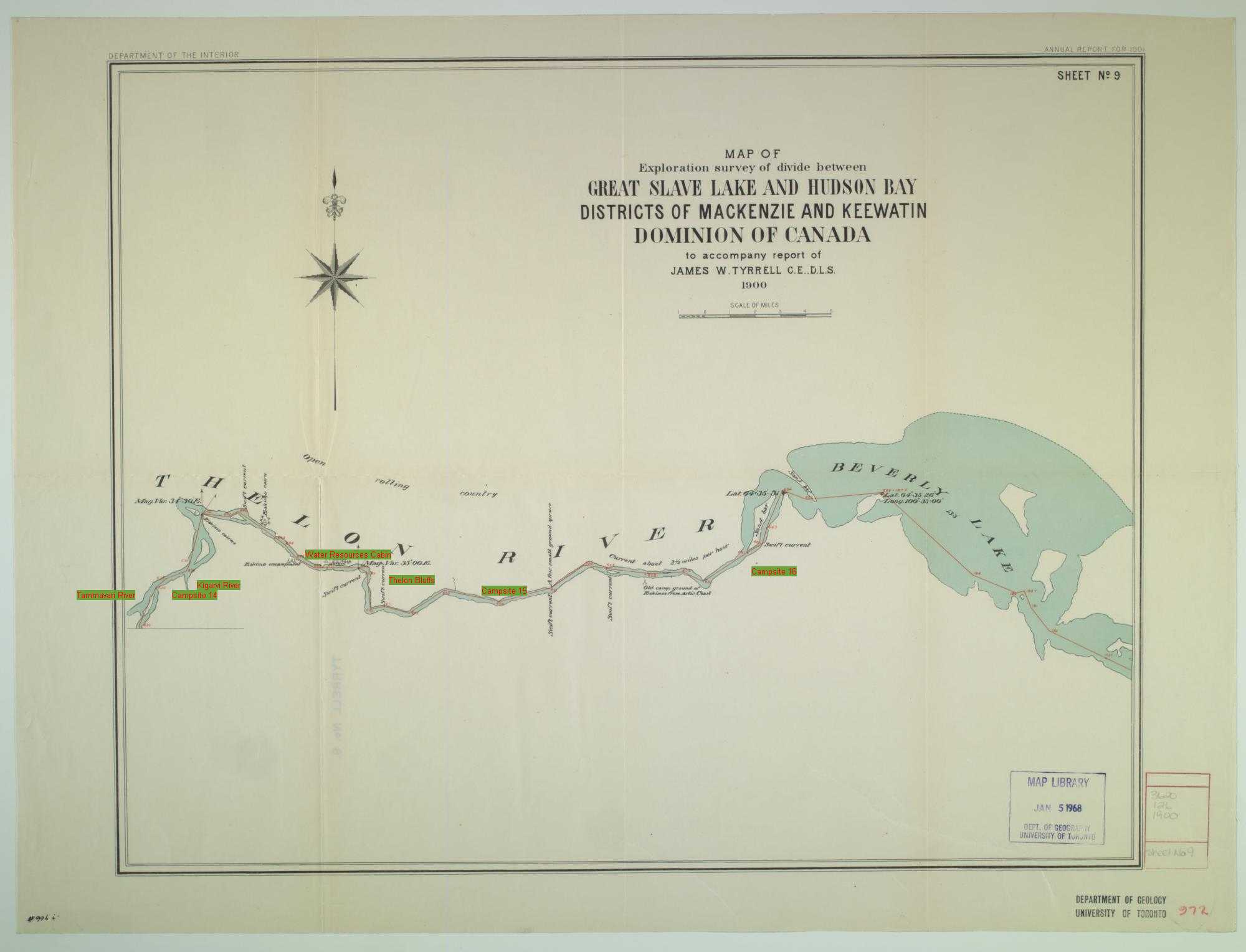
We continue on to the Kigarvi River were we
camp for the night. We do some hiking and as we settle down for a evening drink see a wolf
prowling the bush for dinner. It’s good to know that they do not see us as an easy
target but something to be very wary of.
It is windy again. A very tough paddle into the wind before the river
turns and the wind is finally at our back. Tundra Tom has lost
a canoe as we notice one almost buried in the sand on an island. The weather is windy and
rainy again. We head for the water resources cabin and stop for lunch and an extended stay
while waiting for the weather to improve. The cabin contains a picture of the water level
at the cabin door. It would be a 50-foot raise to get to that level from the current
level. As we leave the cabin a small moose is seen across the river. We climb the Thelon
bluffs and rebuild an old cairn there. The view from here is spectacular. We have left the
treed part of the Thelon valley. We are now truly in the barrens. We camp at a site 15k
from were we will be picked up. It will be a short easy paddle tomorrow.
Another great day we can float to our pickup site in only a couple of
hours. We find a great archaic site, littered with kayak parts, qamutiq parts and tent rings.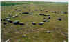 Lots of stone implements cover the ground. This site has been used for a long time. We
hike to Beverly Lake. We pass Inuit graves and more stone
rings.
Lots of stone implements cover the ground. This site has been used for a long time. We
hike to Beverly Lake. We pass Inuit graves and more stone
rings.
Again we see wolves on each side of the river and a caribou crossing
the river. We come across a jeager having a meal, more concerned about losing its meal
than of us.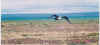
We wait for the plane. Off in the distance as it approaches 6:00 PM we
see a twin otter quickly bear down directly on us. GPS’s are wonderful. We had
provided exact coordinates and they arrived right at the point. We quickly loaded and
departed our Thelon trip
over.
Another 2002 Thelon Trip
http://shippw.homestead.com/index.html


